Oil Town “Aero Views”
Cartographer visited petroleum boom towns to draw popular bird’s-eye views.
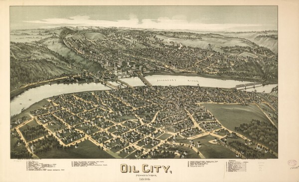
Thaddeus M. Fowler created detailed, panoramic maps of America’s earliest petroleum boom towns during the late nineteenth and early twentieth centuries. His popular cartographic depictions of oil patch communities in Pennsylvania, Oklahoma, and Texas offered “aero views” seemingly drawn from great heights.

More than 400 Thaddeus Fowler panoramas have been identified. There are 324 in the Library of Congress, including this one of Oil City, Pennsylvania, in 1896. Source: Library of Congress Geography and Map Division, Washington, D.C.
Fowler has the largest number of panoramic maps in the collection of the Library of Congress (LOC) in Washington, D.C. His hand-drawn lithographs have fascinated viewers since the Victorian Age. Being depicted in one of Fowler’s maps, also known as “bird’s-eye views,” was a matter of civic pride for many community leaders. (more…)

