Reports of a “mineral tar” from the 1840s helped H.L. Hunt discover an oilfield a century later.
Swallowing “tar pills” supposedly had been curing ills since the mid-1800s, but Alabama’s petroleum industry officially began in 1944 with a Choctaw County well drilled by a Texas wildcatter. On February 17, independent producer Haroldson Lafayette “H.L.” Hunt completed his Jackson No. 1 well after discovering Alabama’s first oilfield.
H.L. Hunt had found success in the earliest Arkansas oilfields of the 1920s and even greater success in the East Texas oilfield of the 1930s. He now had revealed the Gilbertown oilfield of western Alabama, about 50 miles southeast of Meridian, Mississippi.
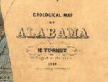
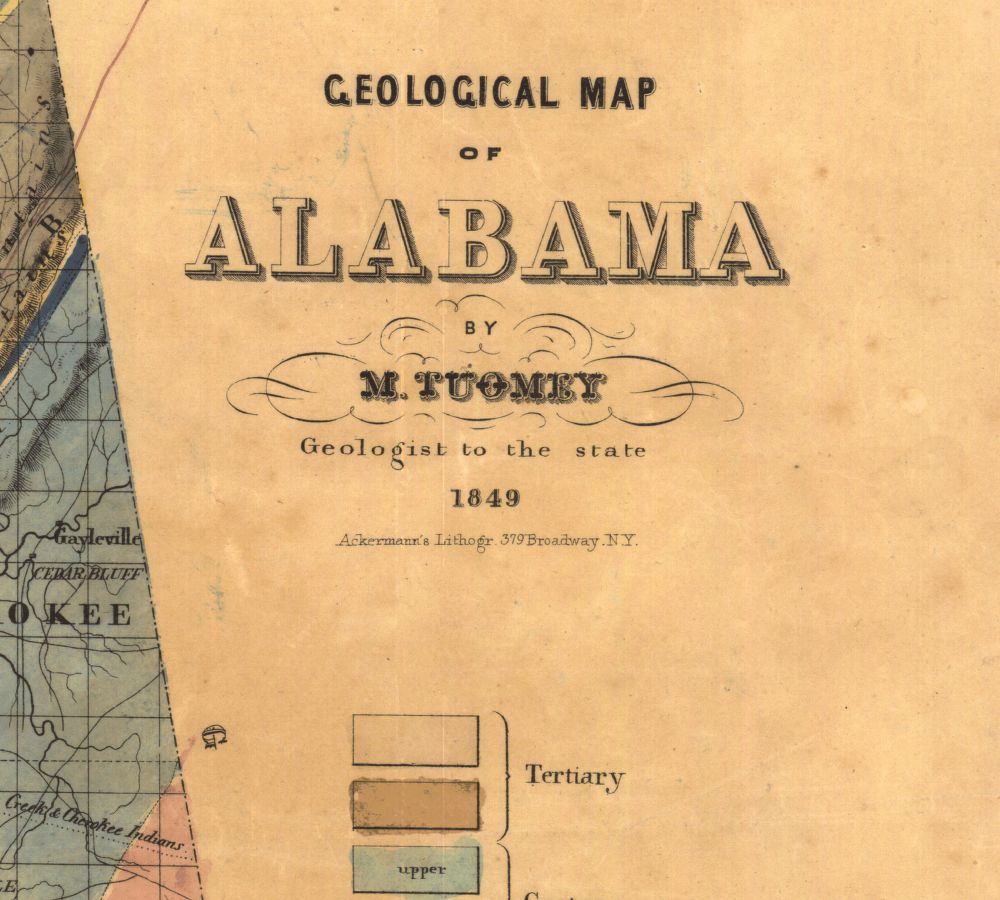
Geological Map of Alabama, printed in 1849 by Michael Tuomey, professor of geology, mineralogy, and agricultural chemistry at the University of Alabama. Tuomey published his First Biennial Report of the Geology of Alabama in 1850. Map courtesy University of Alabama Libraries Special Collections.
Despite limited knowledge of the state’s geology, regions with oil and natural gas seeps had attracted interest as early as the mid-19th century. Before Hunt’s Choctaw County wildcat well, 350 dry holes had been drilled in Alabama.
Geologist and petroleum historian Ray Sorenson has investigated the earliest reports of petroleum in all producing states. By the early 2020s, his ongoing project documented the first signs of oil in the United States, Canada, and many parts of the world (see Exploring Earliest Signs of Oil).
In Alabama’s case, Sorenson uncovered an account by an early expert in the scientific field of geology. The first Alabama state geologist, Michael Tuomey, described reports of a “mineral tar” and cited an 1840s account of finding natural oil seeps six miles from Oakville in Lawrence County.
With quantities of oil and water emerging from a crevice in limestone, Tuomey observed that “the tar, or bitumen, floats on the surface, a black film very cohesive and insoluble in water.”
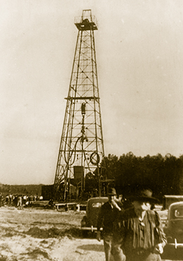
The A.R. Jackson No. 1 well in 1944 revealed an Alabama oilfield near the Mississippi border. Photo courtesy Hunt Oil Company.
Similar to “Kentucky oil,” Alabama’s Lawrence County oil became popular for its medicinal qualities. Oil from the county was claimed to be “a known cure for Scrofula, Cancerous Sores, Rheumatism, Dyspepsia,” and other diseases.
“Patients visiting the Spring find the tar taken and swallowed as pills, the most efficient form of the remedy,” Tuomey quoted the observation from “Tar Spring of Lawrence” in the 1858 Second Biennial Report On the Geology of Alabama (published one year after his death).
Tuomey served as the state geologist of South Carolina from 1844 to 1847, and as the first state geologist of Alabama from 1848 until his death in 1857. Tuomey published his Geological Map of Alabama in 1849.
In addition to oil, traces of natural gas were discovered in Alabama in the late 1880s, and by 1902, natural gas was being supplied to Huntsville and the town of Hazel Green, according to Alabama historian Alan Cockrell.

“In 1909, a small discovery by Eureka Oil and Gas at Fayette fueled that city’s streetlights for a time, but no natural gas was recovered anywhere in the state for several decades afterward,” he added. Learn about the earliest oilfield discoveries in other producing states in First Oil Discoveries.
Gilbertown Oil Discovery
According to Cockrell, Alabama’s oil and natural gas industry did not truly begin until H.L. Hunt of Dallas, Texas, drilled in Choctaw County near the Mississippi border and discovered the Gilbertown oilfield.
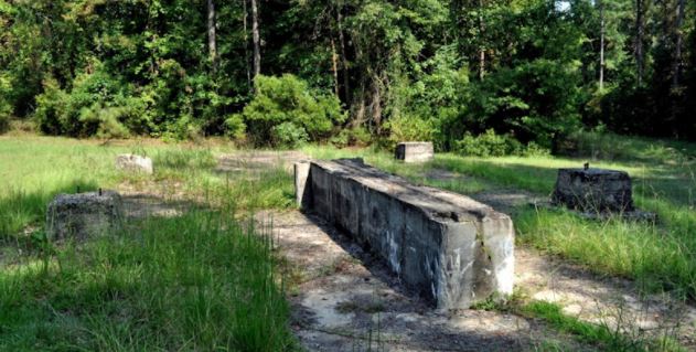
Concrete foundations are all that remain of Alabama’s first oil well, the A.R. Jackson Well No. 1, completed in 1944 near Gilbertown. Photo courtesy Explore Rural S.W. Alabama.
After five weeks of drilling, the well was completed on February 17, 1944, at 2,585 feet in the Selma chalk of the Upper Cretaceous. Hunt’s A.R. Jackson Well No. 1, two miles southwest of downtown Gilbertown, had reached a total depth of 5,380 feet before being “plugged back” to its most productive oil-producing geologic formation.
H.L. Hunt’s first Alabama oil well produced just 30 barrels of oil a day but launched the state’s petroleum industry. “The discovery of this well led to the creation of the State Oil and Gas Board of Alabama in 1945 and to the development and growth of the petroleum industry in Alabama,” notes an Alabama historic marker erected at the site.

Deeper drilling led to more Alabama petroleum discoveries in the 1980s. Map courtesy Encyclopedia of Alabama.
The first oilfield would produce 15 million barrels of oil, “not a lot by modern standards but enough to make ‘oil fever’ spread rapidly,” Cockrell noted in “Oil and Gas Industry in Alabama” in 2008. The search for another oilfield took 11 more years.
The 1955 oil discovery at Citronelle, a town above a geologic salt dome, finally launched a new drilling boom; five new Alabama oilfields were discovered by 1967. Mobil Oil Company drilled Alabama’s first successful offshore natural gas well in 1981.

As production technologies advance, geologists believe opportunities exist in the “hard shales of the deep Black Warrior Basin beneath Pickens and Tuscaloosa counties and in the thick fractured shales of St. Clair and neighboring counties,” according to Cockrell.
By 2022, more than 17,500 oil and natural gas wells had been drilled in Alabama since the state’s first commercial oil discovery in 1944. According to the Washington, DC-based Independent Petroleum Association of America (IPAA), about 10 percent of the Alabama wells produced oil, 59 percent natural gas, and 30 percent (about 5,000 wells) were nonproductive.
Mapping Mineral Riches
From the journal Cartographic Perspectives of the North American Cartographic Information Society (NACIS):
Settlement of the newly available land enabled Alabama to move rapidly from being a part of the Mississippi Territory to its own Alabama Territory and finally to statehood in 1819. The favorable climate and rich soil brought large plantations and slavery.
Appointed State Geologist of Alabama in 1848, Michael Tuomey served until his death in 1857.
Michael Tuomey (1805-1857), professor of geology at the University of Alabama in the 1840s, had attempted to lead Alabama’s economy away from slavery-based agriculture. In 1849, he produced the first survey of the state’s mineral wealth. His geological map of Alabama showed exactly where the state’s natural riches were located. The efforts of Tuomey and others were rejected, as were similar efforts in other southern states.
_______________________
Recommended Reading: Lost Worlds in Alabama Rocks: A Guide
_______________________
The American Oil & Gas Historical Society (AOGHS) preserves U.S. petroleum history. Please support AOGHS to help maintain this energy education website, a monthly email newsletter, This Week in Oil and Gas History News, and expand historical research. Contact bawells@aoghs.org. Copyright © 2026 Bruce A. Wells.
Citation Information – Article Title: “First Alabama Oil Well.” Authors: B.A. Wells and K.L. Wells. Website Name: American Oil & Gas Historical Society. URL: https://aoghs.org/petroleum-pioneers/first-alabama-oil-well. Last Updated: February 13, 2026. Original Published Date: October 21, 2017.